Our journey through Gabon moves from the Atlantic capital into river country, then follows forest and railway connections inland. Rainforest covers much of the country, but its resources do not bring equal benefits to every household.
Your route
Five places, one journey
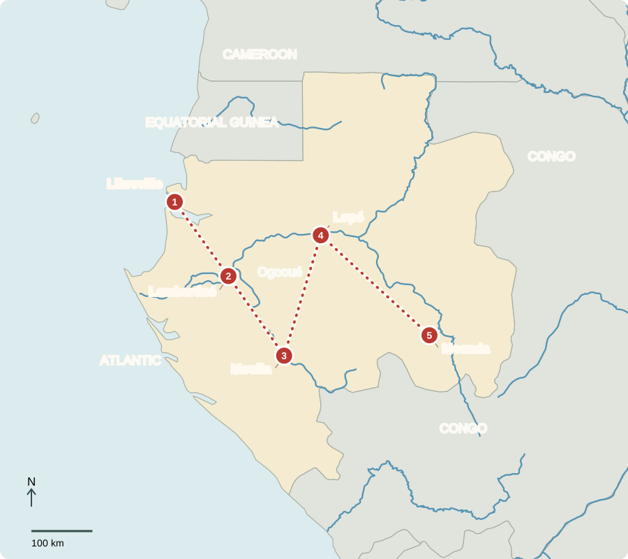
Libreville
A capital facing the Atlantic
Libreville’s offices, markets and port connect Gabon with overseas trade. Oil has financed public investment, yet unemployment and unequal access to services persist. A military coup interrupted government in 2023; a new constitution and elections followed in 2024–25. The president holds strong executive powers. Christianity is widespread, alongside Islam and Indigenous beliefs.
Fruit stalls show another side of the economy alongside oil exports. Urban families buy food brought from farms or imported through ports, so transport prices affect the cost of everyday meals.
Locate this stop on the map ↗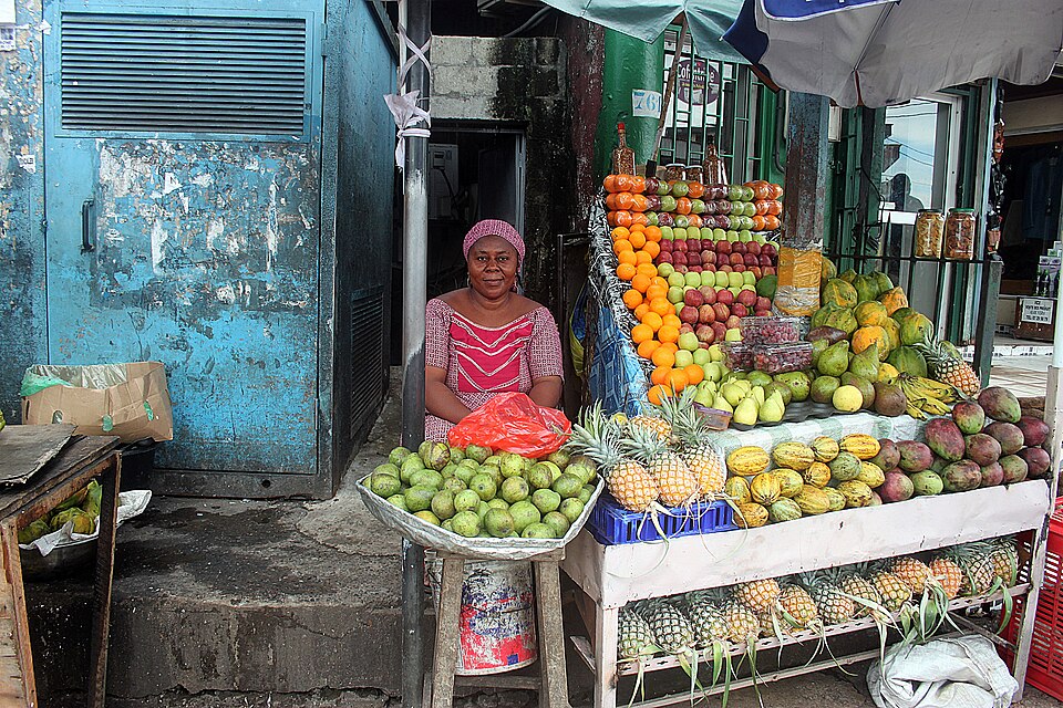
Lambaréné
Life along the Ogooué
Following the Ogooué inland brings us to Lambaréné. Boats connect riverside settlements; fishing and crops such as cassava and plantains support meals and livelihoods. Flooding can damage homes, and distant communities face obstacles reaching health care. Portuguese traders reached the coast in the 1400s. French colonial expansion later pursued trade and forest resources; Gabon became independent in 1960.
The river is both a source of food and a route between communities. Keeping it clean connects public health with fishing, transport and the protection of habitats farther downstream.
Locate this stop on the map ↗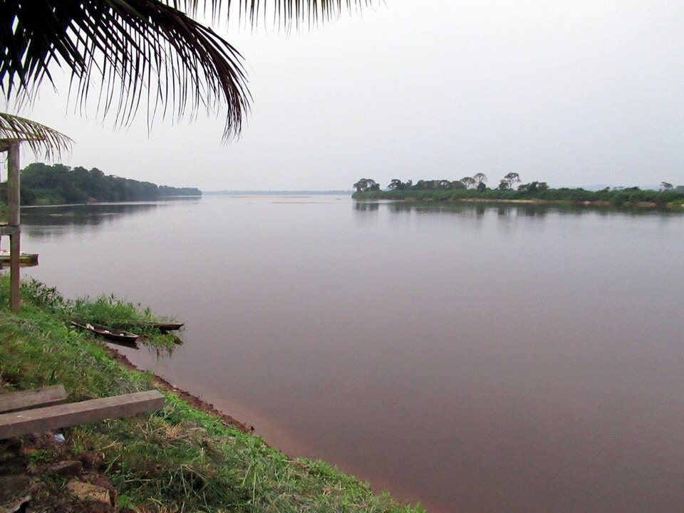
Mouila
A white face and a tall dance
Southward, the Ngounié region is home to Punu communities. Mukudj masks combine carved wood, pigment and white kaolin clay. An idealized woman’s face, shaped hair and facial markings express beauty; kaolin connects with ancestors and the spiritual realm. Skilled male performers wore these masks while dancing on tall stilts. One tradition cannot represent all Gabonese art.
View the lesson’s museum object
Locate this stop on the map ↗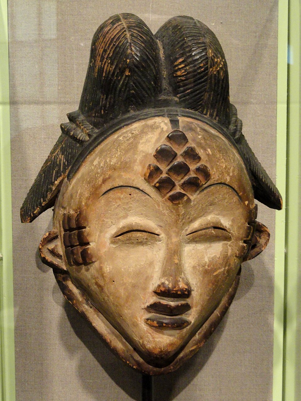
Lopé
Where grassland meets forest
Turning northeast reaches Lopé, where old savanna patches meet dense rainforest. Forest elephants and other wildlife move through this varied habitat. Conserving it protects species and carbon stored in trees, while nearby communities need workable livelihoods. Research and tourism provide possibilities, but poaching and careless forest clearance threaten them.
Locate this stop on the map ↗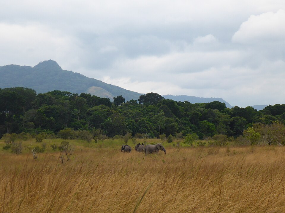
Moanda
Ore traveling by railway
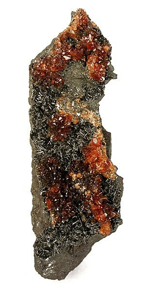
Farther along the inland transport corridor, Moanda’s manganese ore is used in steelmaking. Rail carries heavy cargo toward the coast, linking a mineral deposit to distant factories. Mining and timber processing offer jobs, but water pollution and forest damage need controls. Expanding skills, reliable electricity and food production can reduce dependence on oil and imported goods.
Manganese is different from iron ore, although both can enter the steel industry. A mineral deposit becomes economically useful only when extraction, transport, processing and markets can be connected.
Locate this stop on the map ↗