
Our journey through Libya links coastal cities with desert oases. Distances are great, and conflict makes travel difficult. Along the way, we follow two resources that connect these places: water and oil.
Your route
Coastal cities and desert oases
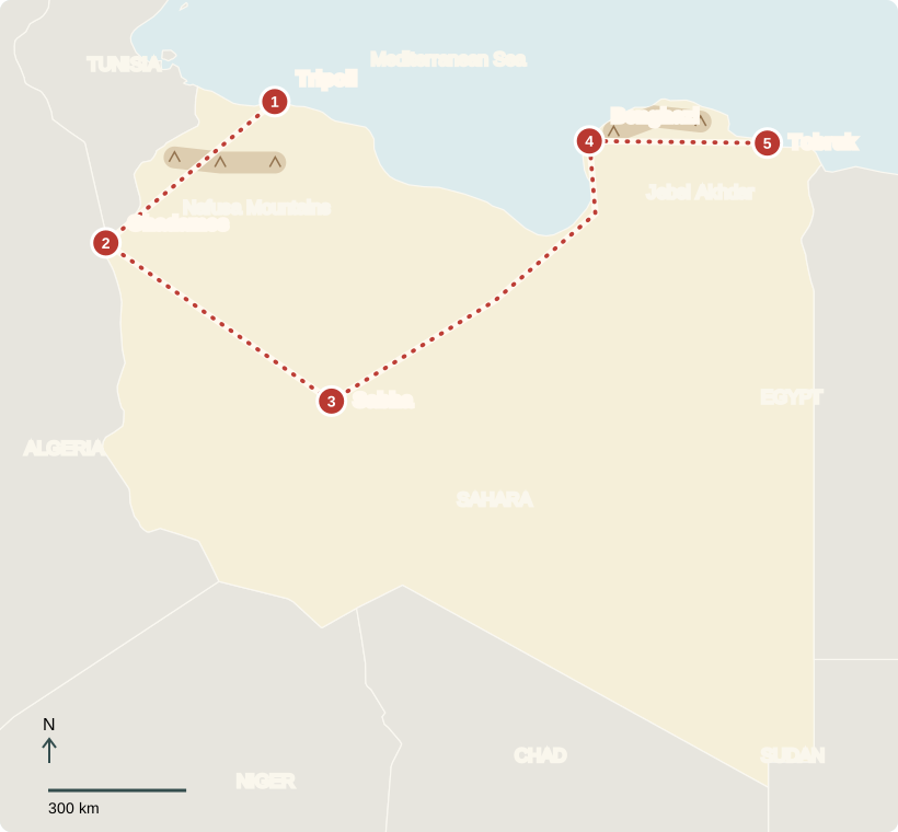
Tripoli
Life beside the Mediterranean
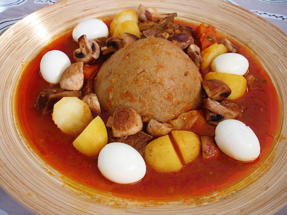
Our first stop is Tripoli, Libya’s capital and largest city. Market stalls, apartment buildings, and the harbor share this coastal setting. Most Libyans live near the Mediterranean, where conditions are milder than in the desert interior. Arabic is the main language; Amazigh and other communities maintain additional languages. Most people are Muslim. A traditional meal might include bazin, a barley-dough mound served with sauce.
Children attend school and spend time with family; football is a popular sport. Daily routines differ, and interrupted services can make ordinary tasks harder.
About 88% of Libyans lived in urban areas in 2025. Oil and gas development helped cities grow by financing jobs, roads, housing, and services; people moved toward these opportunities. The Mediterranean coast has milder, wetter winters and hot, dry summers; most of the interior is Sahara desert.
Locate this stop on the map ↗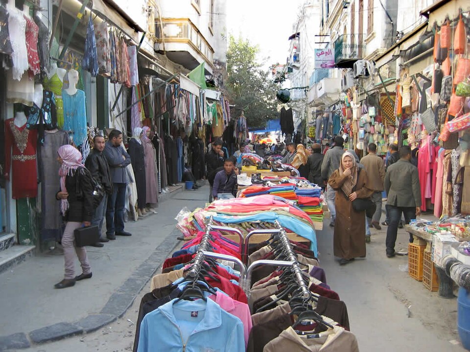
Ghadames
Streets beneath a roof
Southwest, Ghadames stands near the Algerian and Tunisian borders. Its old town has covered passages and thick earthen walls that limit the desert heat. Rooftop terraces once formed another network of routes. Palm gardens grew around the oasis’s water supply. These buildings show how design can make a harsh climate more livable, though many residents now live outside the historic center.
The architecture also creates shared spaces between homes, reminding us that adapting to heat involves the whole neighborhood, not just one building.
Farmers grow dates and olives, along with vegetables and grains such as wheat. Sheep and goats provide meat and milk. Farming clusters along the coast and in irrigated oases; scarce water limits output, so Libya imports much of its food.
Locate this stop on the map ↗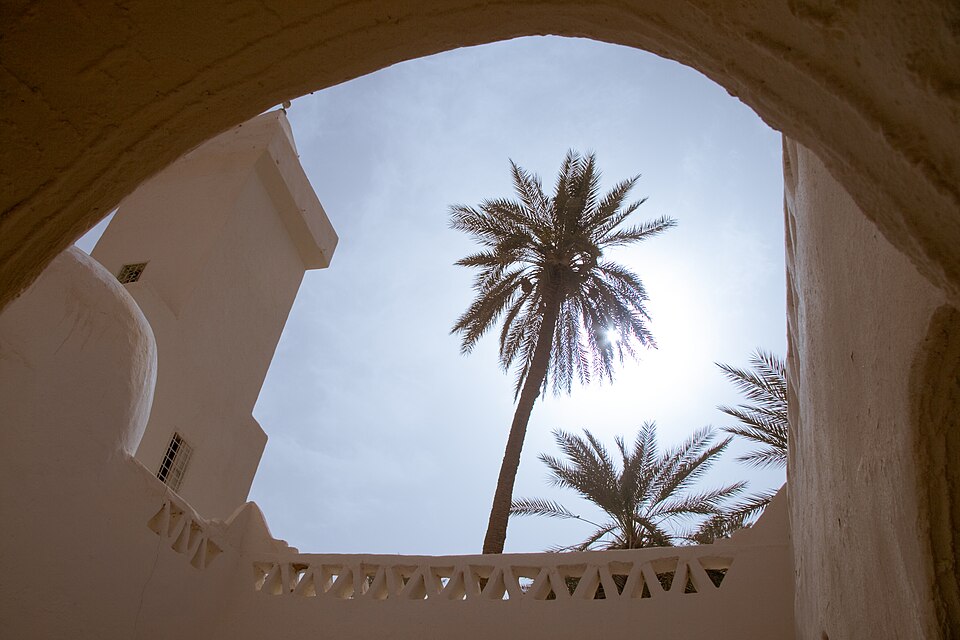
Sabha
Water stored underground
Across the desert, we reach the Sabha region. Beneath parts of southern Libya lie aquifers: layers of rock holding ancient groundwater. The Great Man-Made River network pumps this water north through enormous pipes to farms and cities. Very little rain replaces it. A resource that looks abundant underground can still run short when people withdraw it faster than nature replenishes it.
Irrigated fields can appear as green circles where rotating sprinklers water crops. Their shape is a clue to the machinery and scarce water that make farming possible.
Locate this stop on the map ↗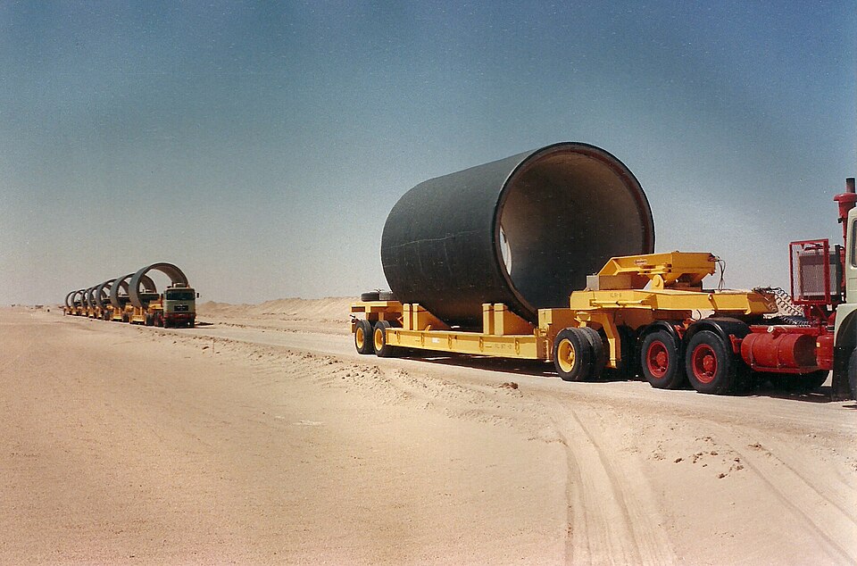
Benghazi
A city rebuilding connections
Our route returns northeast to Benghazi on the coast. Universities, businesses, and neighborhoods need dependable roads, electricity, and water. Years of conflict have damaged services and displaced families. Libya has rival authorities in its western and eastern regions; planned national elections have repeatedly stalled. This division makes shared decisions and rebuilding harder. The United Nations supports efforts to reunite institutions and agree on elections.
Locate this stop on the map ↗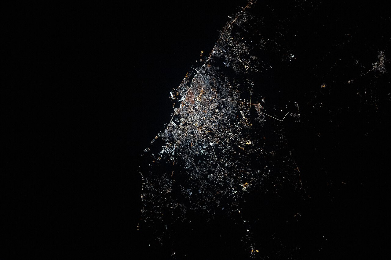
Tobruk
Oil and the sea
Farther east, Tobruk brings us back to shipping. Nearby oil facilities connect Libya’s petroleum industry with the Mediterranean. Oil exports supply much of the money used for public salaries and services, so production stoppages or falling prices affect daily life. Fishing, shops, and other businesses also matter. Developing more kinds of work could make the economy less dependent on one resource.
Much of the oil starts its journey inland. Pipelines and coastal terminals turn a resource hidden beneath the desert into a product sold across the sea.
Locate this stop on the map ↗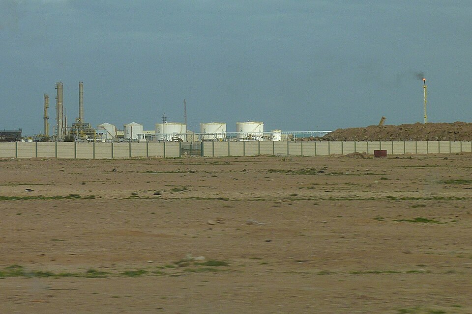
Libya’s coast and desert depend on each other. Water sustains cities; oil pays many bills. Peace and reliable services matter everywhere.