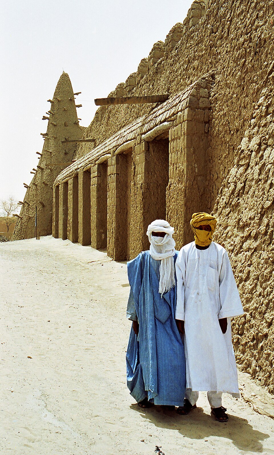
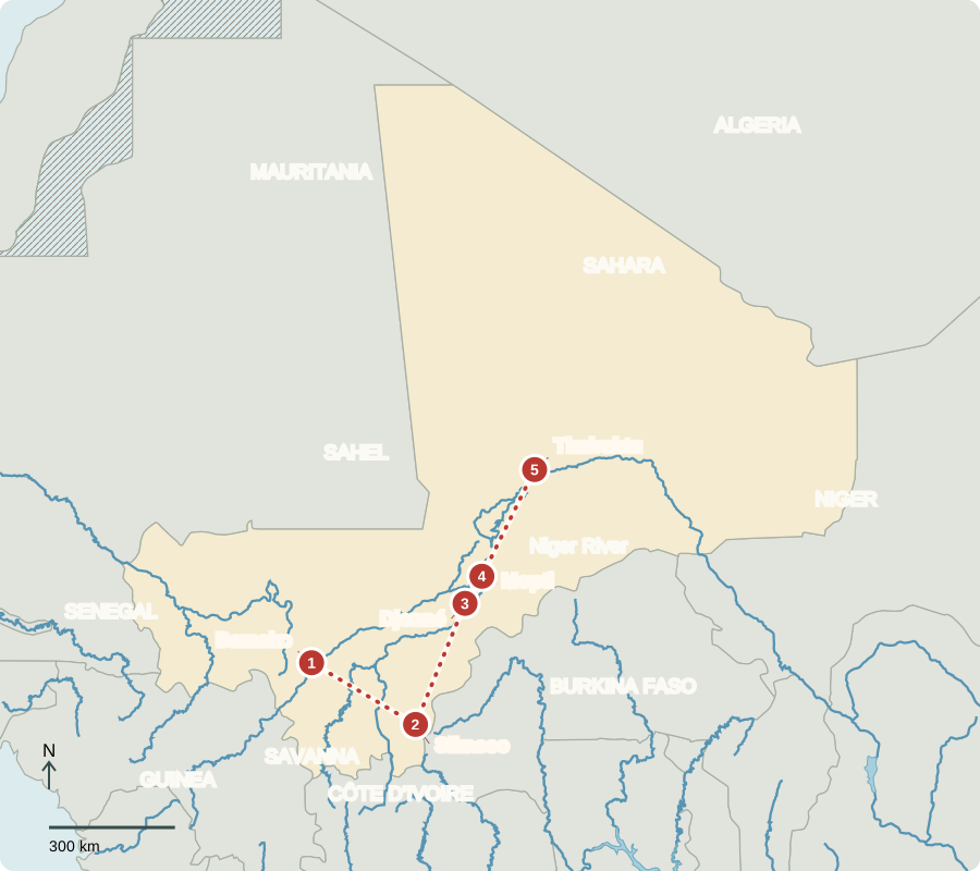
Our journey through Mali starts beside the Niger River. We travel through the wetter south before following waterways toward the Sahara. Distances are long, and conflict restricts access to some stops.
Your route
Five places, one journey
Bamako
A river city with many voices
Bridges connect neighborhoods in Mali’s capital. Markets sell farm produce, while musicians draw on traditions passed between generations. Griots, also called jeliw in Manding traditions, use songs, poetry and stories to preserve history and teach lessons. Their performances connect memory with music. Most Malians are Muslim. Mali gained independence from France in 1960; military authorities now lead a transition, limiting ordinary electoral choices.
Mali has no coastline. Imported goods and exported cotton or gold must cross borders to reach seaports, adding transport costs to the price of trade.
Locate this stop on the map ↗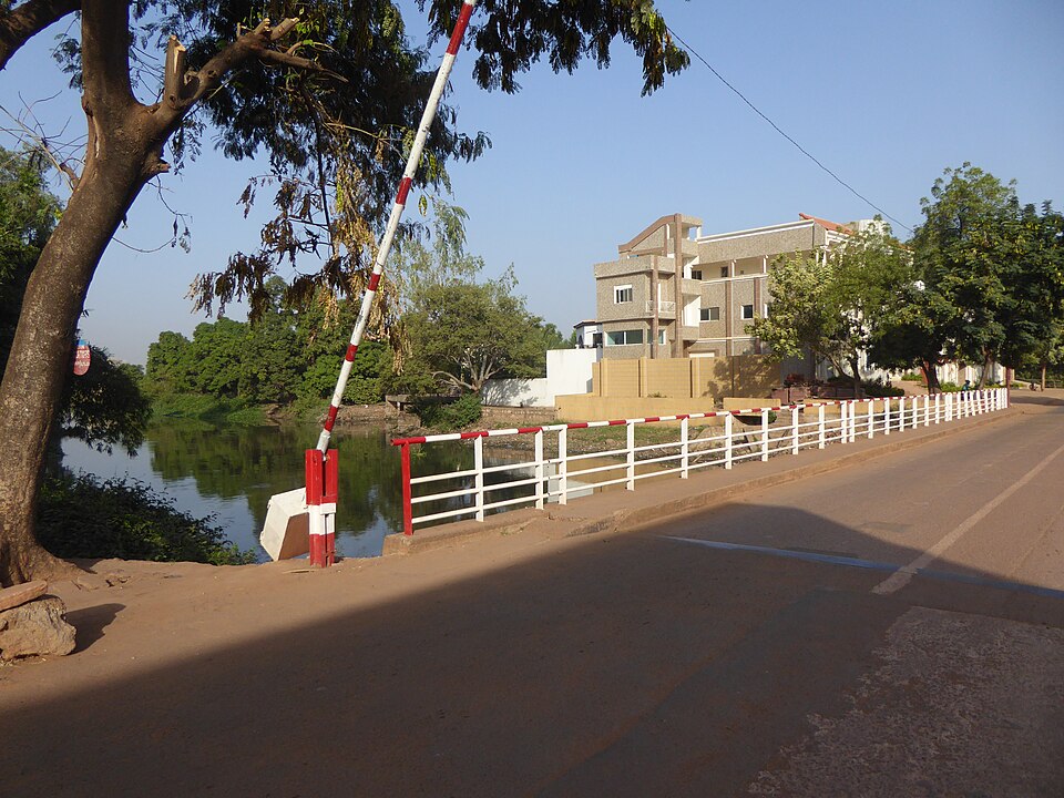
Sikasso
Rain feeds the southern fields
Traveling southeast, we enter a wetter savanna region. Farmers grow maize, millet and cotton, and keep cattle. Cotton supports ginning, which separates fibers from seeds, before export. Gold mining is another major source of export income. Yet many households remain poor. Rainfall, roads, crop prices and access to tools all influence whether natural resources become reliable earnings.
The south receives more dependable seasonal rain than the desert north. That difference concentrates much crop production here, although farming still depends on the year’s weather.
Locate this stop on the map ↗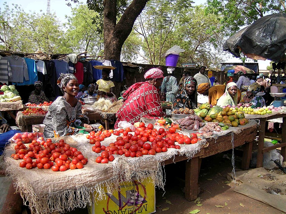
Djenné
A town renewed with earth
We turn north toward Djenné, near the Bani River. The Great Mosque’s earthen walls need fresh plaster to resist rain. Community maintenance links a local building material with shared knowledge and work. This historic trading town connected farmers and merchants. Nearby rice fields depend on water, while drier land supports different crops. Grains made into porridge or served with sauces are everyday foods.
A wall is more than the material it contains. Builders’ knowledge and repeated care turn earth into a structure that can continue serving a community.
Locate this stop on the map ↗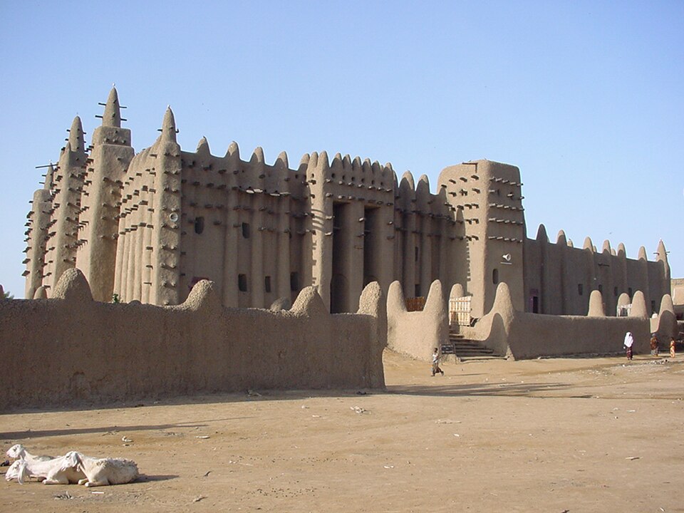
Mopti
A flood becomes a resource
At Mopti, boats connect communities around the Inner Niger Delta. Seasonal floodwaters spread across low ground, creating fishing areas, grazing land and rice-growing opportunities. Farmers adjust planting to water levels, and irrigated areas elsewhere use canals. Flood size varies; drought, upstream water use and extreme floods create problems. The river is a resource for water and transport, not a dependable road in every season.
Different users need the same floodplain at different times. Fishers, herders and farmers all depend on the rhythm of rising and retreating water.
Locate this stop on the map ↗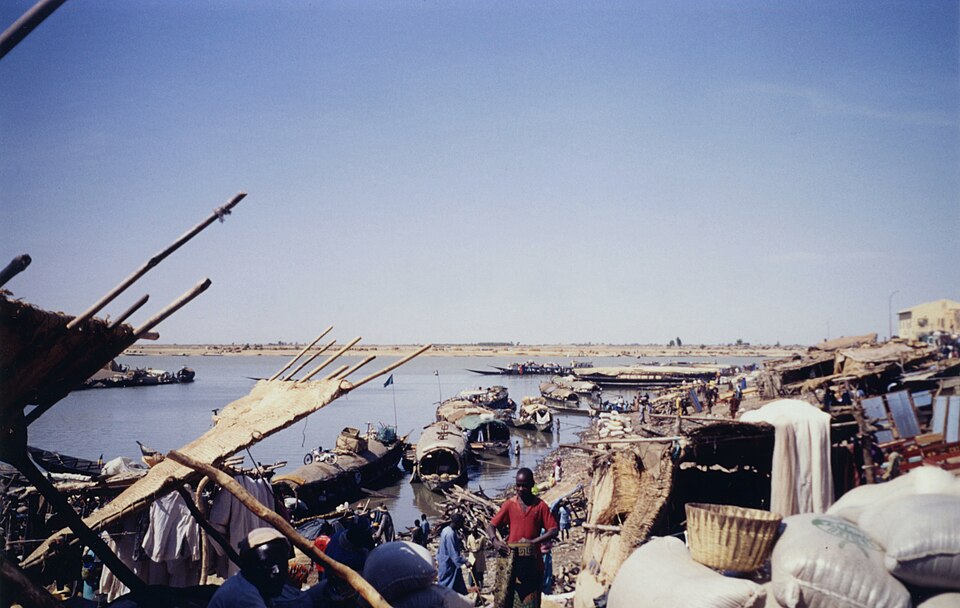
Timbuktu
Learning at the desert’s edge
Continuing northeast, we reach Timbuktu near the Sahara. Mosques and manuscripts recall centuries of scholarship and trade. Northern Mali is desert; the middle includes dry Sahel grasslands, while the south has wetter savanna. Salt and other mineral deposits occur in the north. Protecting cultural collections and sustaining livelihoods are difficult where conflict disrupts schools, markets and travel. Mali’s landscapes change greatly from one stop to another.
A savanna is grassland with scattered trees; the Sahel is its drier transition toward the desert. These broad regions have changing edges, not sharp walls.
Locate this stop on the map ↗