Our journey through Mozambique follows the Indian Ocean coast north from Maputo. Long road and air transfers connect these stops; the dotted line is not a travel route. Tropical summers bring rain, and cyclones can strike the coast.
Your route
Five places, one journey
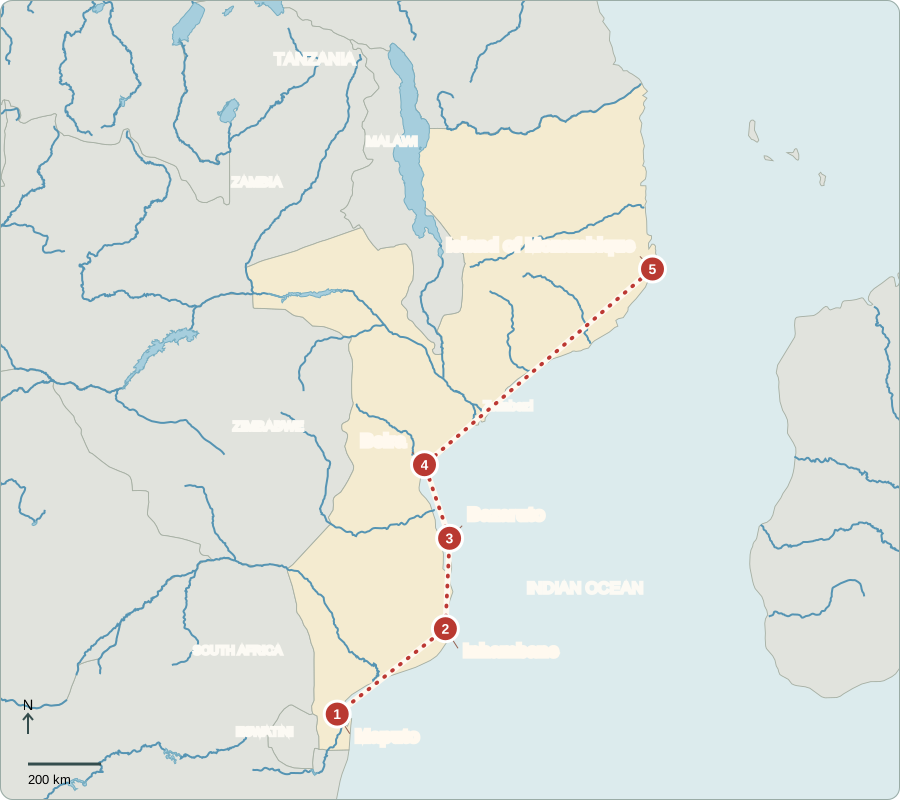
Route lines connect learning stops, not exact roads.
Maputo
A railway station facing the sea
Maputo’s railway station recalls the links between the coast and inland trade. Mozambique became independent from Portugal in 1975; a long civil war followed. Today, voters elect a powerful president and the Assembly of the Republic, which makes laws. The president appoints a prime minister to coordinate government. Opposition parties compete, but disputed elections and restrictions on protest raise concerns about citizens’ influence.
Portuguese is the official language, but Makhuwa, Tsonga, Sena and many others are spoken. The urban area extends toward Matola, an important industrial city. Ports and railways help explain why towns developed around connections to inland producers.
Locate this stop on the map ↗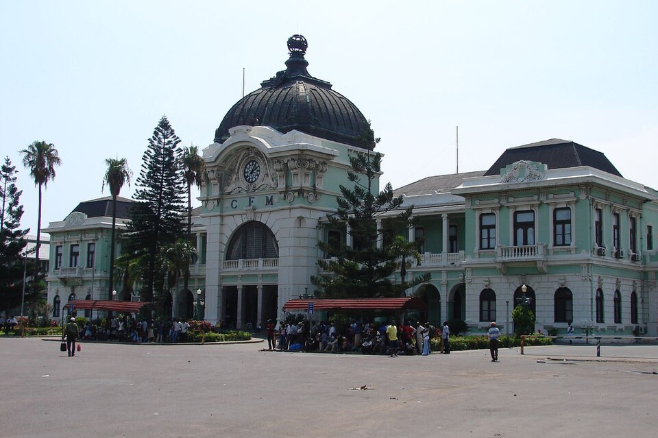
Inhambane
Sails, coconuts and coastal kitchens
Traveling northeast, we reach Inhambane’s sheltered bay. Dhow sailing boats recall centuries of Indian Ocean trade. Fishing and coconut palms shape coastal livelihoods, while farms inland grow cassava and maize. Matapa combines cassava leaves with ingredients such as ground peanuts and coconut milk. Markets connect growers and fishers with town households. Unreliable roads and storms can interrupt those connections.
Coastal food traditions show how ingredients and trade meet. Fish and coconut connect a meal with nearby water and palms, while cassava comes from cultivated land. Fishing households and inland growers contribute different foods to the same town markets.
Locate this stop on the map ↗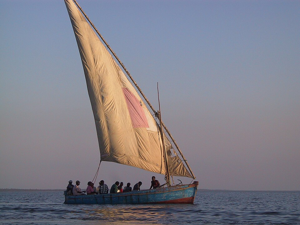
Bazaruto
Seagrass beneath the surface
Farther north, boats reach the Bazaruto islands from the mainland. Sand dunes rise above shallow water and seagrass beds where dugongs feed. These marine mammals depend on healthy coastal habitat. Fishing and tourism provide income, but nets, heavy use and habitat damage threaten wildlife. Conservation works best when local fishing communities help shape how the area’s resources are used.
Seagrass grows underwater in shallow coastal areas. Unlike seaweed, it is a flowering plant. Its beds provide food for dugongs and habitat for other marine life, so damage below the water can affect livelihoods above it.
Locate this stop on the map ↗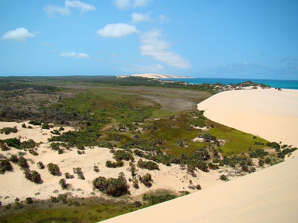
Beira
A low city exposed to storms
Continuing north brings us to Beira, a port serving Mozambique and inland neighbors. Its low coastal position makes flooding especially dangerous. Cyclone Idai caused severe damage in 2019. Improved drainage and mangrove protection can reduce some risks, while stronger buildings and warning systems help people prepare. Ports move coal, farm products and other goods; natural gas is another important resource farther north.
Mangroves are trees adapted to coastal water. Their roots help hold sediment and shelter young marine animals. Protecting them can support fisheries as well as reduce erosion, although no natural barrier can prevent every flood or storm impact.
Locate this stop on the map ↗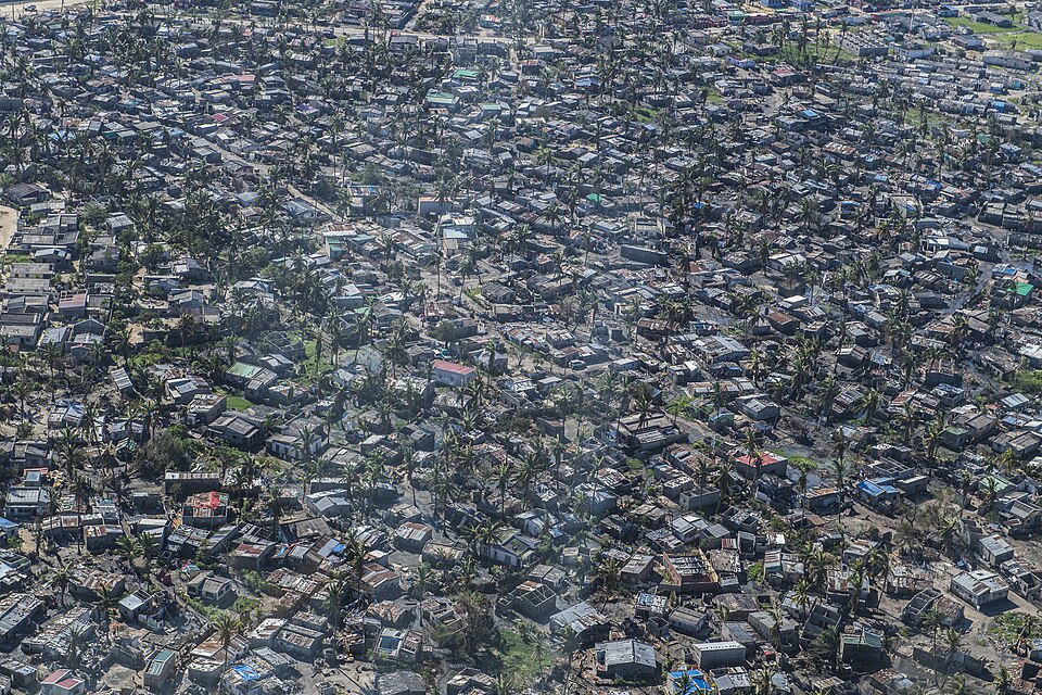
Island of Mozambique
Coral stone and ocean history
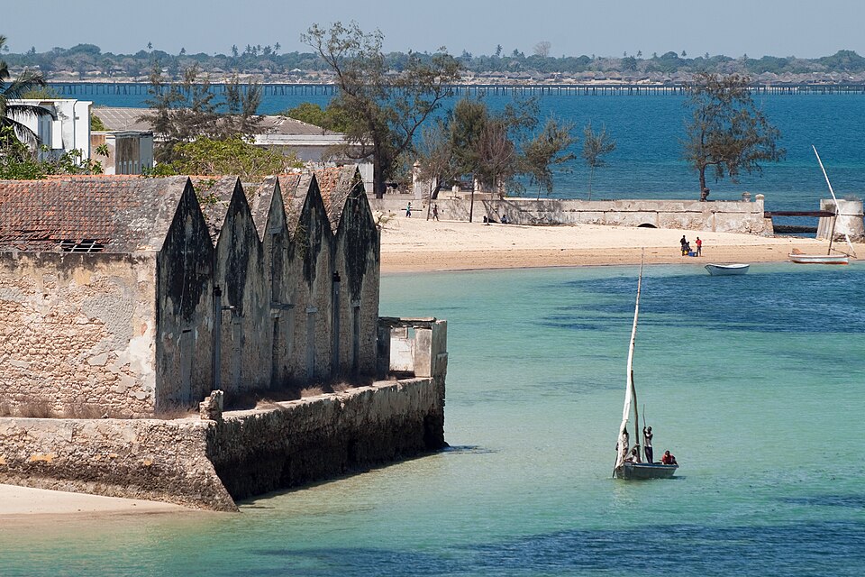
After another long transfer north, we reach the Island of Mozambique. Coral-stone buildings reflect African, Arab, Indian and Portuguese connections. The island was once an important Portuguese trading center. Its architecture reveals how ocean trade brought people, beliefs and building methods together. Tourism offers work, but poverty and limited services remain challenges. Armed conflict in Cabo Delgado, farther north, has displaced communities and restricted travel.
Stone Town and the island’s other neighborhoods show different building materials and living conditions. Preserving historic buildings requires maintenance alongside everyday services for residents. A heritage site remains a place where people live, not simply a collection of monuments.
Locate this stop on the map ↗