Our journey through Namibia begins on Windhoek’s plateau, turns southwest into the Namib Desert, then follows the coast and northern interior. Vast distances and scarce rainfall separate many settlements.
Your route
Five places, one journey
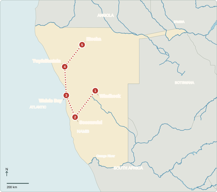
Route lines connect learning stops, not exact roads.
Windhoek
A capital after colonial rule
Windhoek’s streets reflect different periods of history. Germany colonized Namibia; South Africa later administered it and imposed apartheid. Independence came in 1990. Voters directly elect a president, who appoints the prime minister and cabinet. The National Assembly passes laws, with review by the National Council. Citizens vote for representatives, but the presidency holds substantial power. Deep inequalities in income and access to services remain.
English is official, but many Namibians use Oshiwambo languages or other languages in daily life. Settlements are far apart across much of the country. That distance can make delivering water, maintaining roads and reaching services expensive.
Locate this stop on the map ↗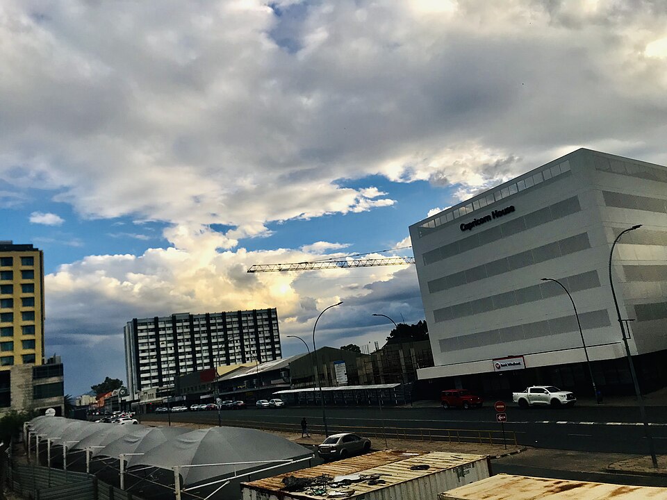
Sossusvlei
Sand shaped by wind
A long drive southwest reaches Sossusvlei’s tall dunes. Wind shifts sand around pale clay pans where water only occasionally collects. The Namib is extremely dry; plants and animals survive through specialized ways of conserving or obtaining water. Tourism creates guiding and lodging jobs, but desert habitats recover slowly from damage. Staying on designated routes helps protect this fragile landscape.
The desert reaches the Atlantic, where cool ocean conditions help limit rainfall. Fog can still bring moisture to coastal habitats. A place can therefore receive very little rain while having damp mornings—a useful distinction between rainfall and other moisture.
Locate this stop on the map ↗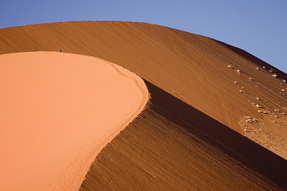
Walvis Bay
A cold sea feeds a port
We head north to Walvis Bay. The cold Benguela Current brings nutrient-rich water that supports fish, including hake. Fishing and processing employ people, while the port connects landlocked neighbors to overseas markets. Offshore diamonds and inland uranium are other valuable resources. The foggy coast contrasts with warmer inland farming areas, where cattle, sheep and goats need grazing and dependable water.
Fish must be landed, stored, processed and transported before reaching distant customers. Each step supports work beyond the fishing boat. The harbor also serves inland countries, showing how one coastal city can connect an entire region to the ocean.
Locate this stop on the map ↗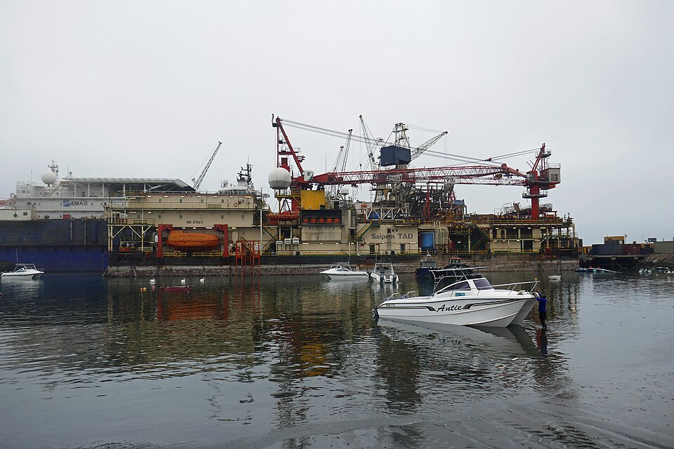
Twyfelfontein
Animals written in stone
Farther north and inland, Twyfelfontein’s rock surfaces carry thousands of engravings. Earlier hunter-gatherers pictured giraffes, antelope and other animals that mattered in their lives and beliefs. These are historical artworks, not evidence that everyone in Namibia follows one tradition today. Local guiding connects heritage with employment. Protecting the rock surfaces keeps a record that cannot be replaced once damaged.
Looking at an engraved animal can reveal what earlier artists observed, but it does not explain every meaning of the image. Archaeological context and careful interpretation matter. Visiting with a guide helps protect the site while learning from it.
Locate this stop on the map ↗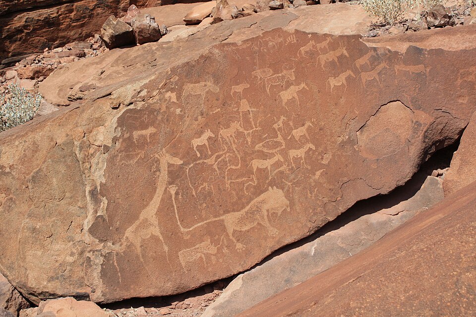
Etosha
Gathering around water
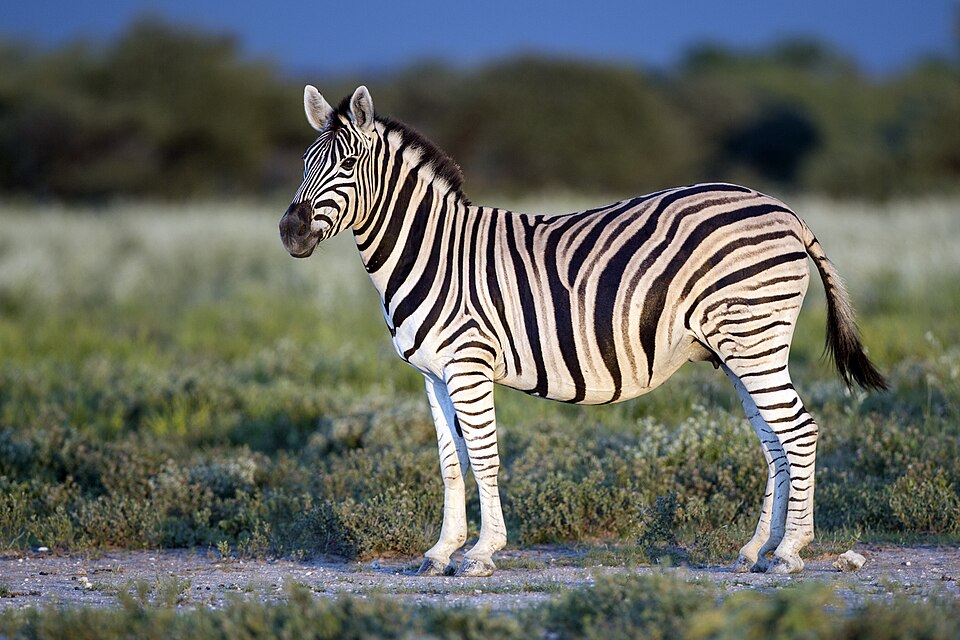
We turn northeast to Etosha, where a vast salt pan lies beside grassland and woodland. During the dry season, waterholes draw zebras, elephants and other animals. Beyond the park, communal conservancies give communities a role in managing wildlife and earning tourism income. Drought, livestock needs and crop damage make that work complicated. Northern farmers also grow mahangu, a pearl millet suited to relatively dry conditions.
Mahangu can be ground into meal for porridge. A drought-resistant crop is useful where rainfall varies, but no crop removes the need to care for soil and water. Rural livelihoods often combine several activities instead of relying on only one.
Locate this stop on the map ↗