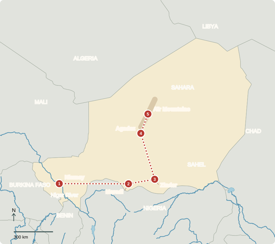
Our journey through Niger begins on the Niger River, follows the more populated south, then turns north into the Sahara. These are widely separated stops; insecurity can restrict travel.
Your route
Five places, one journey
Niamey
A river through a dry country
Along the river, gardens and rice fields contrast with dry ground beyond their reach. Seasonal rises support farming and fishing, but floods can damage homes. The Niger River also carries boats where conditions allow. Niger is landlocked: exports must reach ports through neighboring countries. Independent from France since 1960, it is now governed through a military-led transition rather than an elected civilian administration.
Niger and Nigeria are different countries. The river links them through a much larger basin, so rainfall or water use far upstream can affect places downstream.
Locate this stop on the map ↗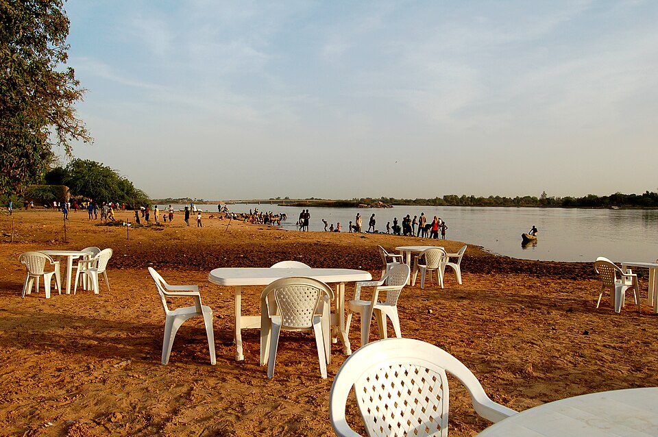
Maradi
Keeping trees in the fields
We travel east through the Sahel. Farmers grow millet, sorghum, cowpeas and groundnuts during a short rainy season. Near Maradi, some protect shoots growing from old tree roots instead of clearing them away. The trees shelter soil, supply useful products and help restore worn farmland. This adaptation matters because drought can ruin harvests. Most people are Muslim; Hausa and several other languages serve everyday life.
Keeping useful trees among crops is different from leaving a field unused. Farmers select and prune growth, combining food production with care for the soil.
Locate this stop on the map ↗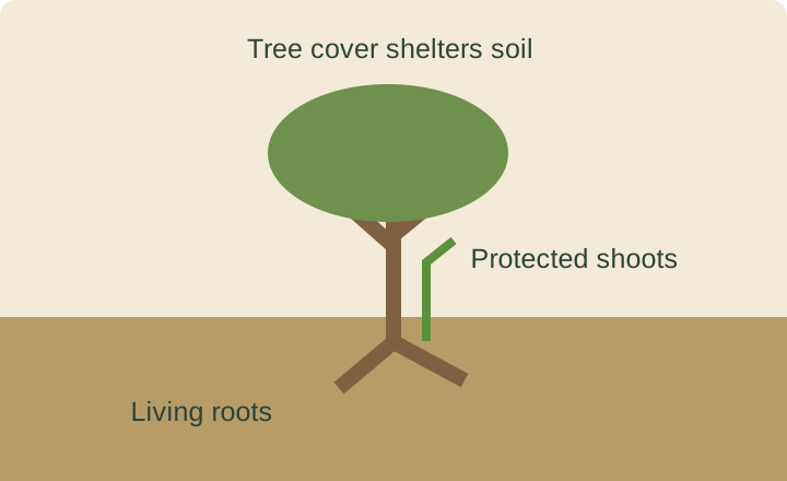
Zinder
Trade across a borderland
At Zinder, markets connect surrounding farms and livestock keepers with buyers, including traders from Nigeria to the south. Onions and other vegetables add variety to Niger’s agriculture, while rice grows where water permits. Cotton is also cultivated, though it is not a leading food crop. Grains may become thick porridge served with sauce. Farming employs many people, but low incomes and unreliable rain make food security difficult.
Herding makes use of land too dry for dependable cropping. Animals supply milk, meat and income, but they also need routes to seasonal water and grass.
Locate this stop on the map ↗
Agadez
A crossroads built from earth
Our route turns north to Agadez, where an earthen mosque rises above the old town. Tuareg and other communities helped connect Saharan trade routes. Buildings made from earth use local materials and require maintenance. Farther north, uranium deposits around Arlit have supplied nuclear-fuel industries. Niger also exports petroleum. Mining and oil bring revenue, but neither removes the country’s widespread poverty or need for diverse jobs.
The city’s mud-brick architecture is a reminder that desert landscapes include skilled builders, markets and long histories, rather than only empty stretches between settlements.
Locate this stop on the map ↗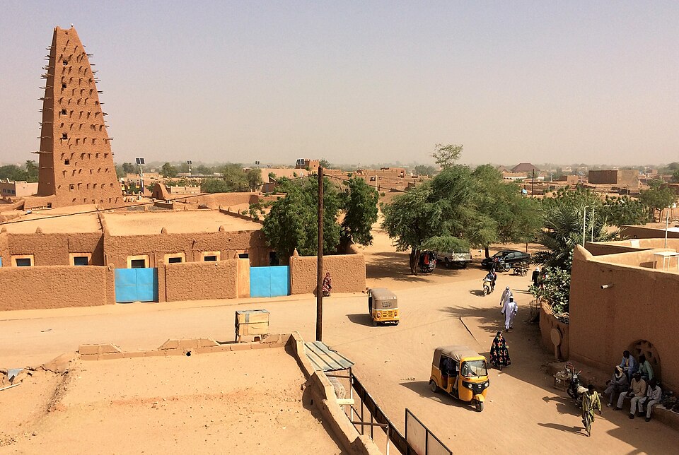
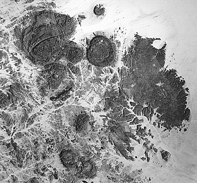
Aïr Mountains
Gardens below the heights
A long transfer leads to rocky mountains surrounded by desert. Most of northern Niger receives very little rain. In valleys where groundwater is available, irrigated gardens can grow vegetables; elsewhere, herders move animals toward pasture and water. The contrast with southern grain fields is sharp. Protecting scarce water and desert wildlife must be balanced with people’s livelihoods. Our route shows learning locations, not a travel recommendation.
Cooler heights, rock surfaces and small valleys create local differences within the desert. A successful garden depends on its water source, not simply its latitude.
Locate this stop on the map ↗