Our journey through Zimbabwe begins in Harare, heads south to an ancient stone city, then northwest toward Victoria Falls. This landlocked country has a cooler central plateau and hotter lowlands, with distinct wet and dry seasons.
Your route
Five places, one journey
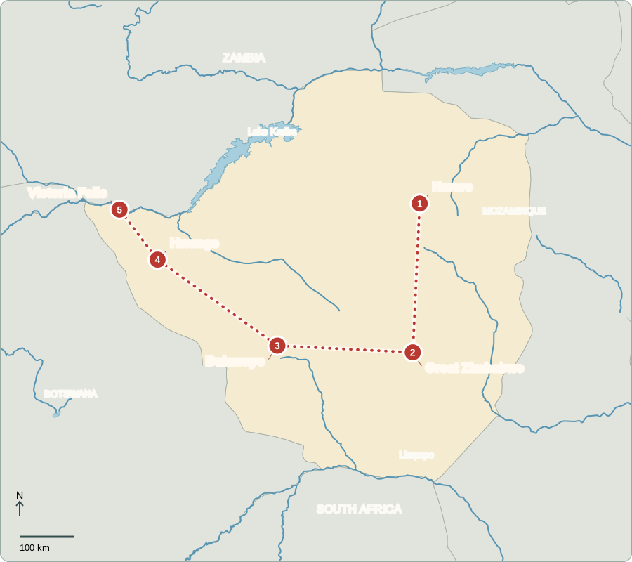
Route lines connect learning stops, not exact roads.
Harare
A capital with changing rules
Harare connects government offices, markets and farms. Zimbabwe gained independence in 1980 after British colonial and white-minority rule. A July 2026 constitutional amendment changed future presidential selection to a joint parliamentary vote. The executive president appoints the cabinet; Parliament makes laws. Citizens elect representatives, but restrictions on dissent weaken accountability. The amendment is contested. Jobs, reliable services and confidence in money remain important concerns.
Shona and Ndebele are widely spoken, alongside English and other recognized languages. Shops may use Zimbabwe Gold, called ZiG, or US dollars. Changing prices and confidence in money can make it difficult for households and businesses to plan.
Locate this stop on the map ↗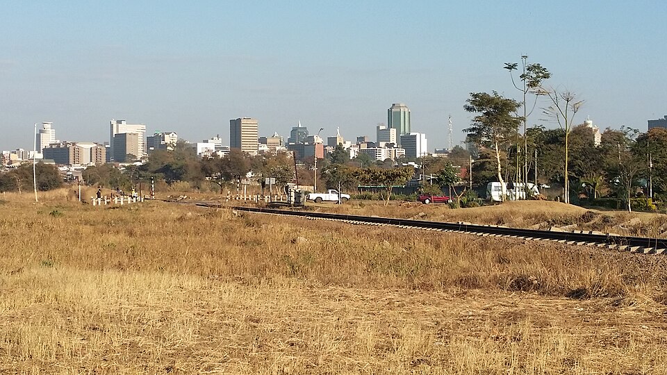
Great Zimbabwe
Walls without mortar
Driving south brings us to Great Zimbabwe. Skilled African builders fitted granite blocks together without mortar, creating impressive walls between the eleventh and fifteenth centuries. The city’s rulers benefited from cattle, farming and trade linked to the Indian Ocean. These ruins show that organized states and long-distance trade existed here centuries before European colonization. The modern country took its name from this heritage.
The word mortar means material used to bind building blocks together. These carefully fitted walls stand without it. Their construction required skill and organization, challenging the old colonial claim that Africans could not have built the city themselves.
Locate this stop on the map ↗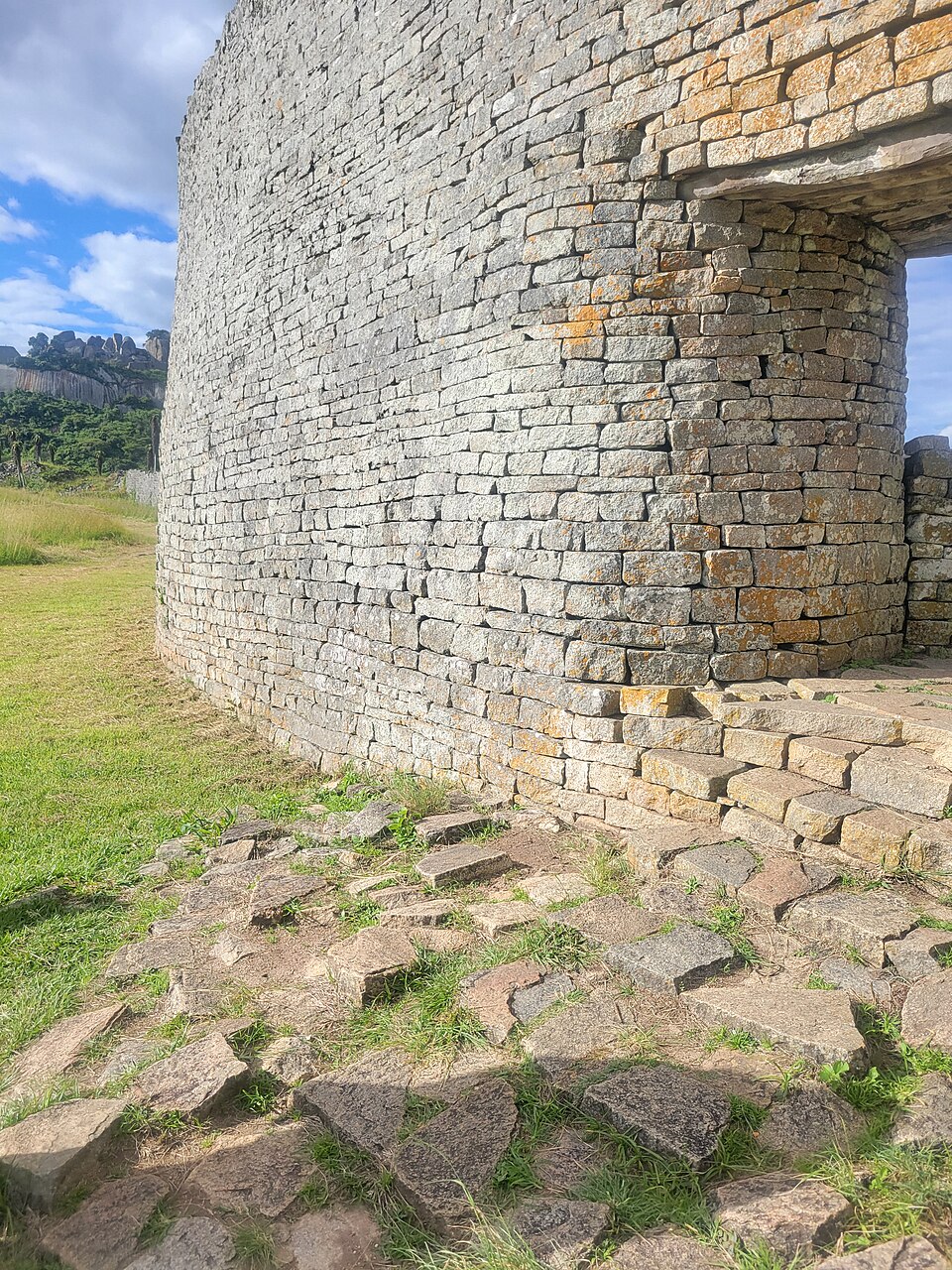
Bulawayo
Tracks through the interior
We turn west to Bulawayo, a city associated with Ndebele history and a major railway junction. Its railway museum preserves locomotives from earlier transport networks. Railways carried minerals and farm products toward distant ports. Zimbabwe exports gold, platinum and tobacco; maize is a major food crop. Sadza, a thick maize porridge, is commonly served with vegetables or meat. Drought can damage harvests and livelihoods.
A railway junction is where routes meet, allowing goods and passengers to change direction. Bulawayo’s position helped connect mines, farms and other towns. Repair workshops and transport services could develop around that movement, not just around making or growing products.
Locate this stop on the map ↗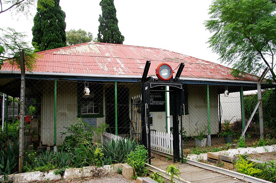
Hwange
Waterholes in dry woodland
Northwest lies Hwange National Park, where elephants move through woodland and grassland. Much of the park lacks permanent surface water, so dry-season waterholes become gathering places. Tourism supports guides and lodges, while nearby communities also need water and land. Protecting wildlife involves tackling poaching and reducing conflicts with farmers. Beyond the park, coal mining supplies fuel but brings environmental costs.
Conservation here involves more than drawing a boundary on a map. Elephants need space and water, while neighboring households need safe crops and livestock. Managing the meeting places between farms and wildlife habitat is an important part of protection.
Locate this stop on the map ↗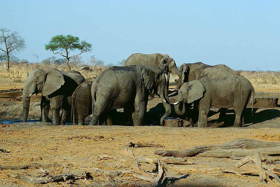
Victoria Falls
One river, two countries
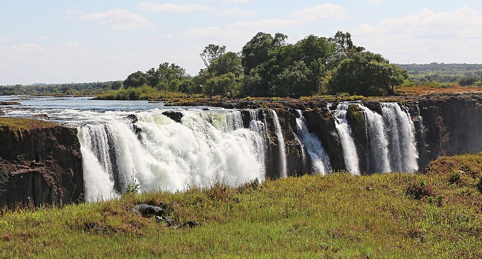
Our final stop is Victoria Falls, shared with Zambia. The Zambezi pours over a basalt edge into a narrow gorge. River flow changes dramatically through the year, so the curtain of water is never exactly the same. Rainfall far upstream affects both the falls and electricity production at Kariba downstream. River conservation, tourism and everyday livelihoods therefore reach across national borders.
Water falling through a gorge can support tourism, while the same river later supplies a reservoir. Those uses respond differently to changing flow. A dramatic waterfall is therefore also part of a working landscape shared by communities upstream and downstream.
Locate this stop on the map ↗